
|
|

 The original proclamation and map, from 1914. This is the act in the Library of Congress, signed by US President Woodrow Wilson that established Papago Saguaro National Monument signed in the City of Washington, on the thirty-first day of January, in the year of our Lord one thousand nine hundred and fourteen, and the Independence of the United States, the one hundred and thirty-eighth. The map of the park that accompanies the proclamation is not very good.
 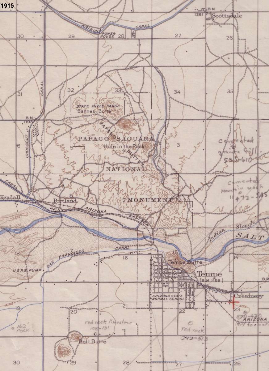 1915 Map of Papago Park area. I don't even know where I got this, but it was labeled 1915. It is one of the few early maps I have seen in which the park is identified as "Papago Saguara National Monument." Notice the remarks added by some ancient enginneer. As usual, Hole in the Rock is one of the few features identified by name.
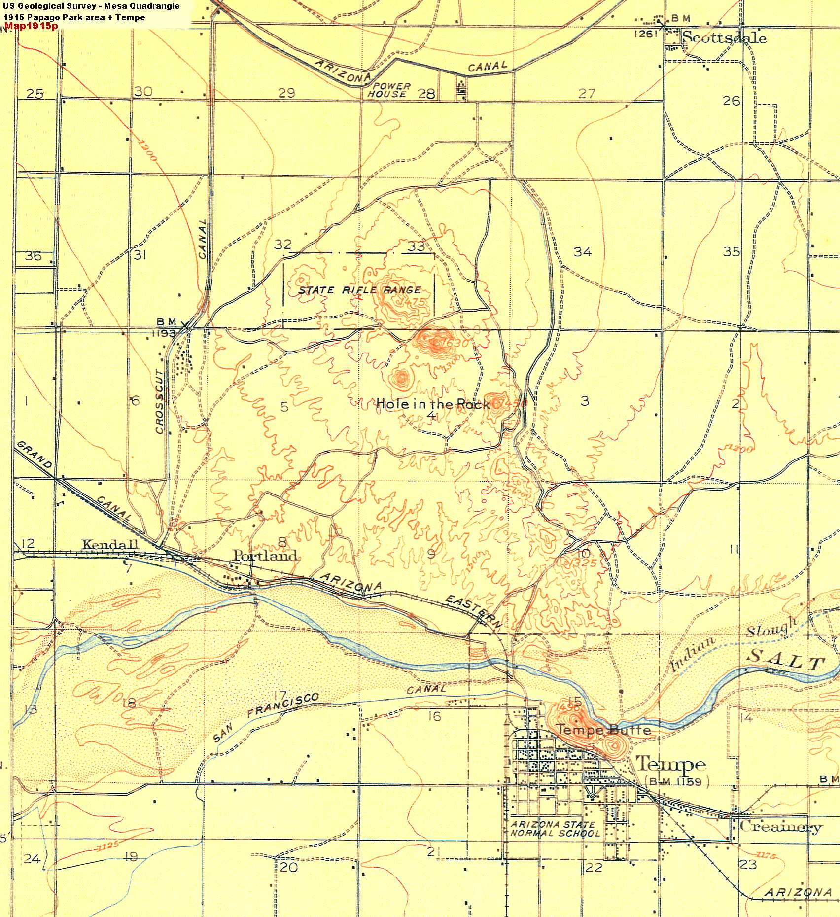 1915 US Geological Survey map of the Mesa Quadrangle. Simple map (partial), showing Tempe and Papago Park area, but with no designation of the Park as a Monument. In fact, only the Hole in the Rock and the "State Rifle Range" are identified. Notice that Scottsdale is one square block and about 20 buildings.
 1937 Airplane Photo of Tempe and Scottsdale. This is from the Fairchild collection at ASU. I have added a few name tags to identify main streets and certain local landmarks. The Park is basically in a natural state - ie, a chunk of desert surrounded by fields and orange groves - except for the bass fisheries (fish ponds / lakes) at the end of the Cross-Cut Canal. The desert terrain of the park sticks out like a sore thumb.
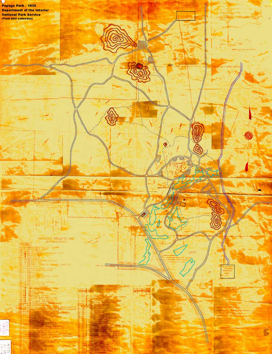 A very important 1935 map. This is one of the most important documents of park history, from the ASU library map collection. It was created by the National Park Service of the Department of the Interior and it shows both "Existing Projects and Improvements" and "Proposed Projects and Improvements." It is not easy to read, so I have traced over the buttes, roads and lakes, and enhanced the contrast and colors so that these are easily visible. The roads have changed significantly, but the lakes hardly not at all.
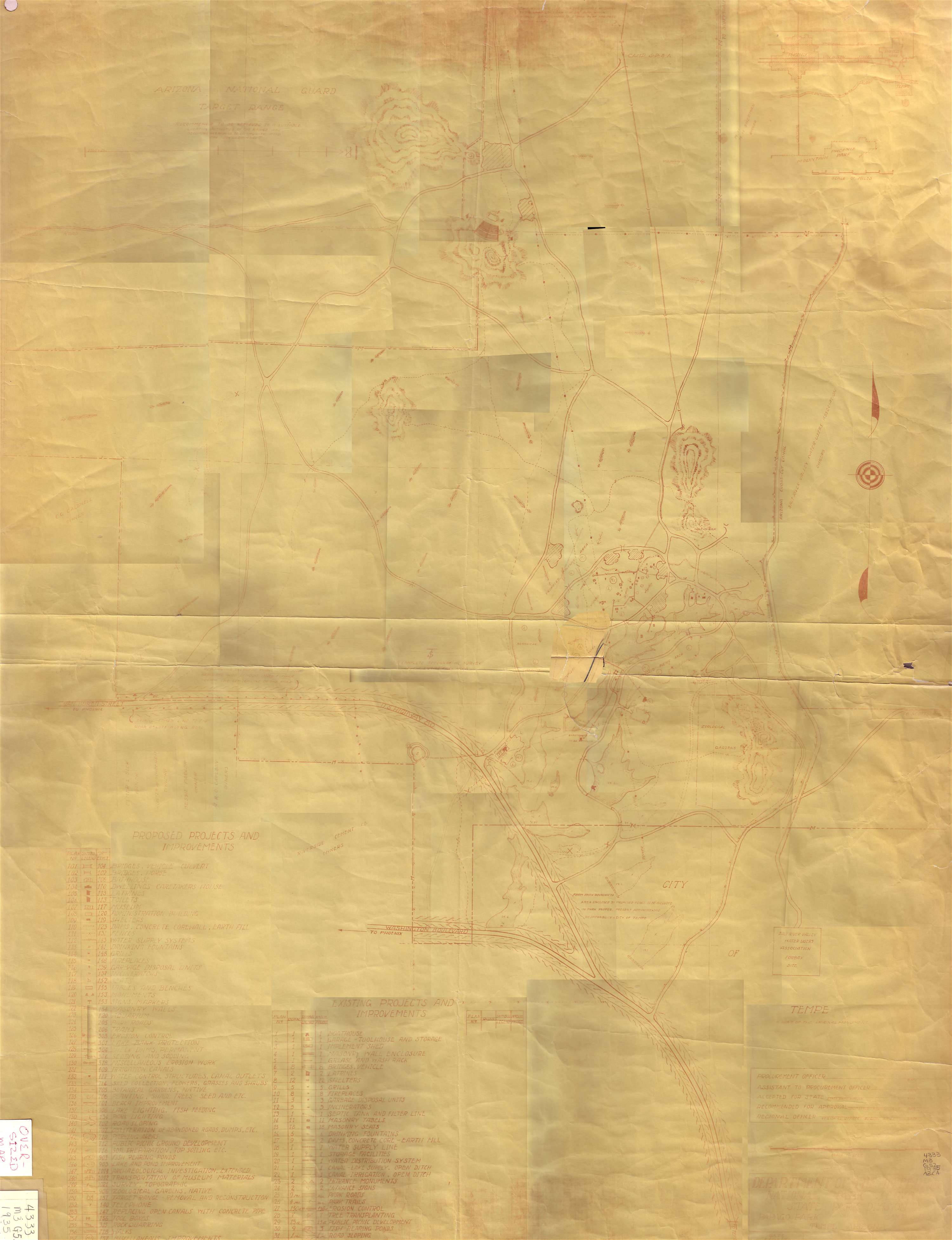 1935 Map, from above, again. The problem is that the map is big (40 by 70 inches, maybe?) and rather hard to read, being printed in red pencil on a dull tan brown background. It is also old, with tears, wrinkles and folds. All of these make it very hard to scan. This is the best I can do, and it is make up of about 30 images put together.
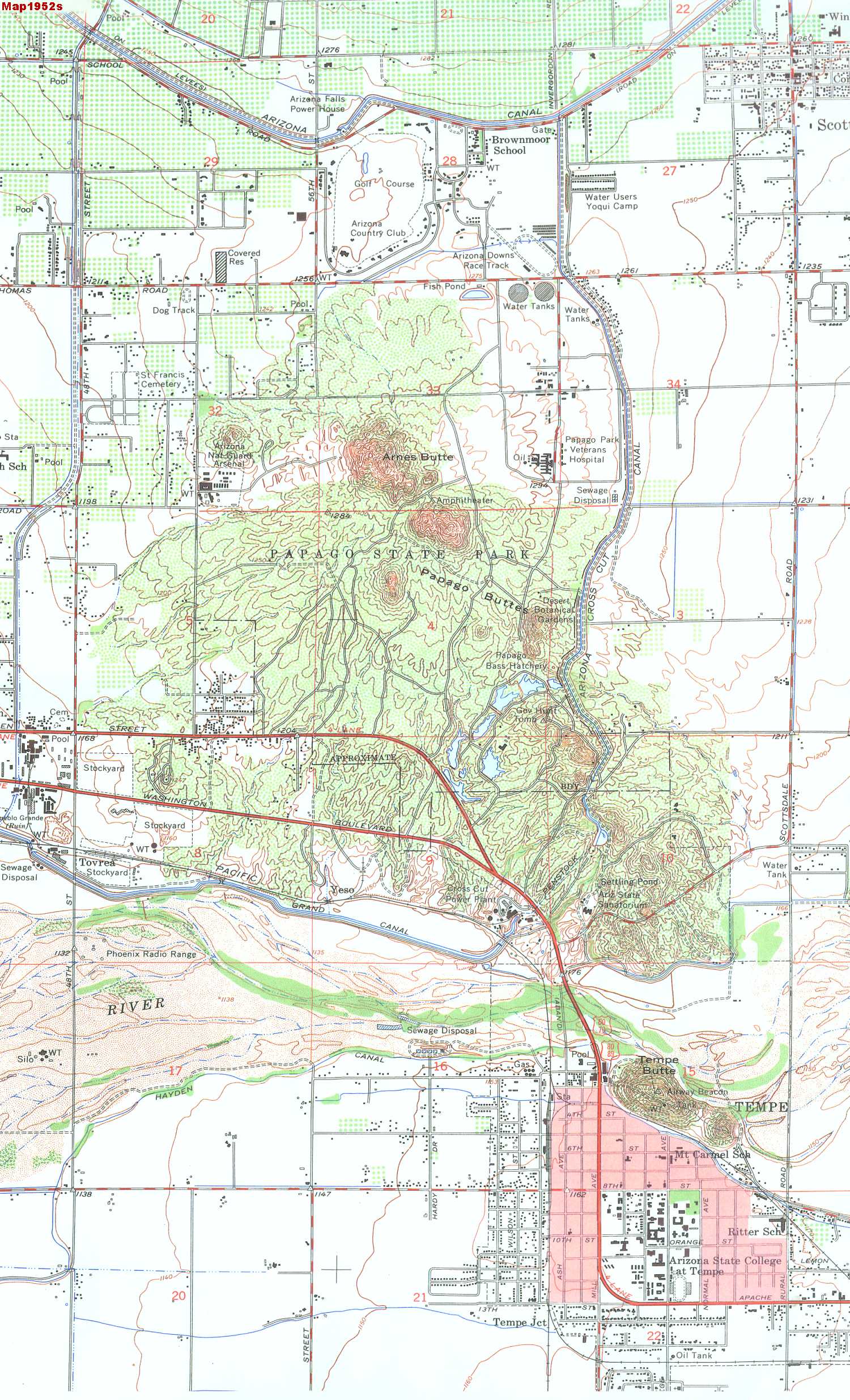 1952 topological map of Tempe and Scottsdale. Now we have Papago State Park, with many recognizable features including the Arsenal, the Amphitheater, the remains of the Old POW Camp including the Veterans Hospital, The Botanical Gardens (in a different location?), the bass hatchery, Hunt's Tomb, The TB Sanitorium, and a hill labeled 'Arnes' Butte. I think they mean 'Barnes' Butte. Outside the park area we have the long-gone Arizona Downs Dog Race track, two water tanks, the fish pond where the Las Casas townhouses are, and the Cross Cut Power plant, which I don't remember. Tempe is growing, and ASU is still ASC, Arizona State College. Ritter School is shown, where I did first grade a couple of times.
 Another 1952 map of the Mesa Quandrangle by the US Department of the Interior and the US Army Corps of Engineers. This is almost identical to the preceding map, but at least they got "Barnes Butte" right.
 1956 Proposed Project. Quote: "A Major Park area for the Valley, providing active and passive recreational facilities, educational interests and inspirational values of contact with the out of doors". Well, they solved the problem of the Amphitheatre being cut off by McDowell Road by moving it north 200 yards. I guess we can see the Disneyland influence (inaugurated that year) in the "Make-Believe-Land" and there is the space for a planned "Mine Exhibit" below Hole in the Rock. The zoo has been relocated north of the lakes and about one-third of the Phoenix portion has been designated as a golf course.
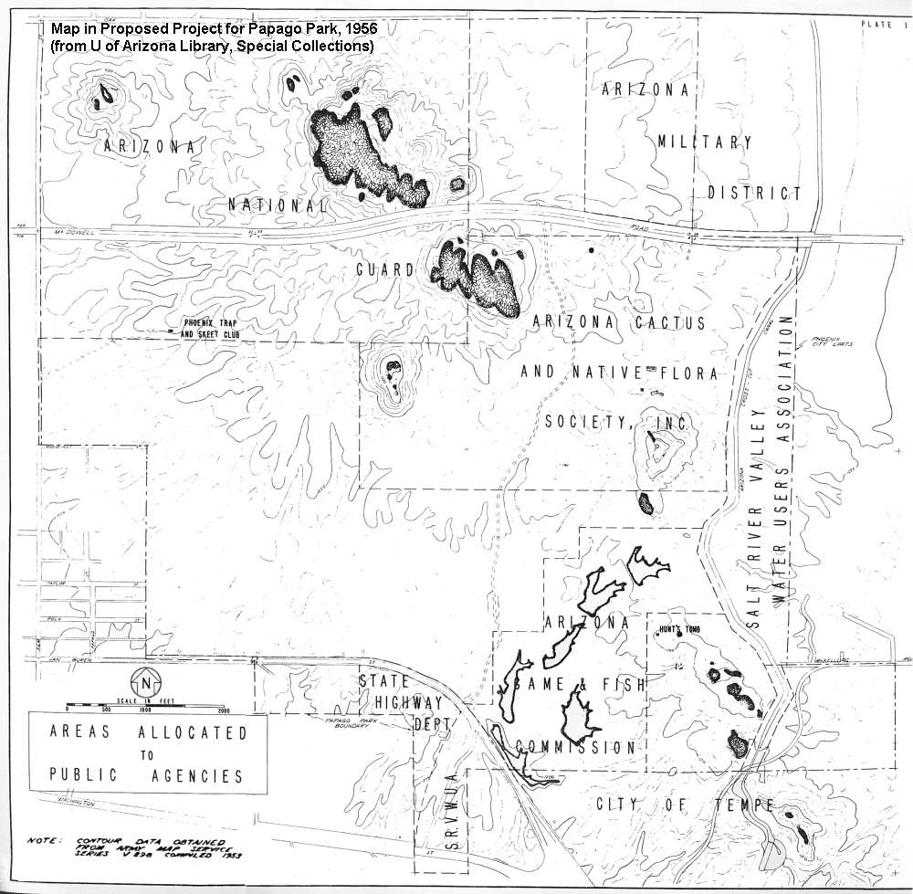 Map from Proposed Project. This is a simple map included in the proposal project book with the map above. It shows "Areas allocated to public agencies". Some of these are: State Highway department, City of Tempe, SRVMUA - Salt River Valley Water Users Association, Arizona Game and Fish Commission, Arizona national Guard, Arizona Military District and the Arizona Cactus and Native Flora Society, Inc.
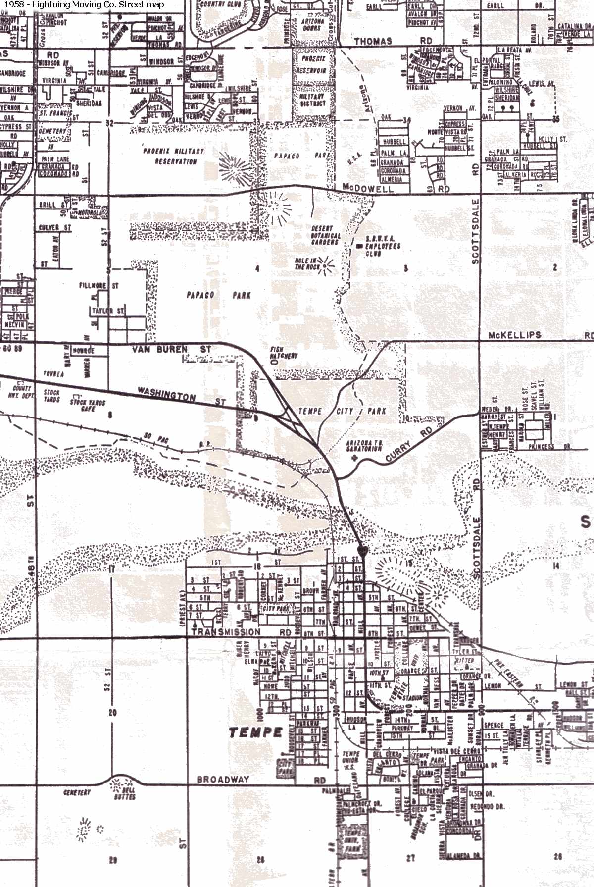 1958 Street map. A simple street map produced by the Lightning Moving company. Slowly, the areas around the park are being occupied as Phoenix, Tempe and Scottsdale expand. Notice the old dog race track north of Thomas Road (Arizona Downs) - long gone!
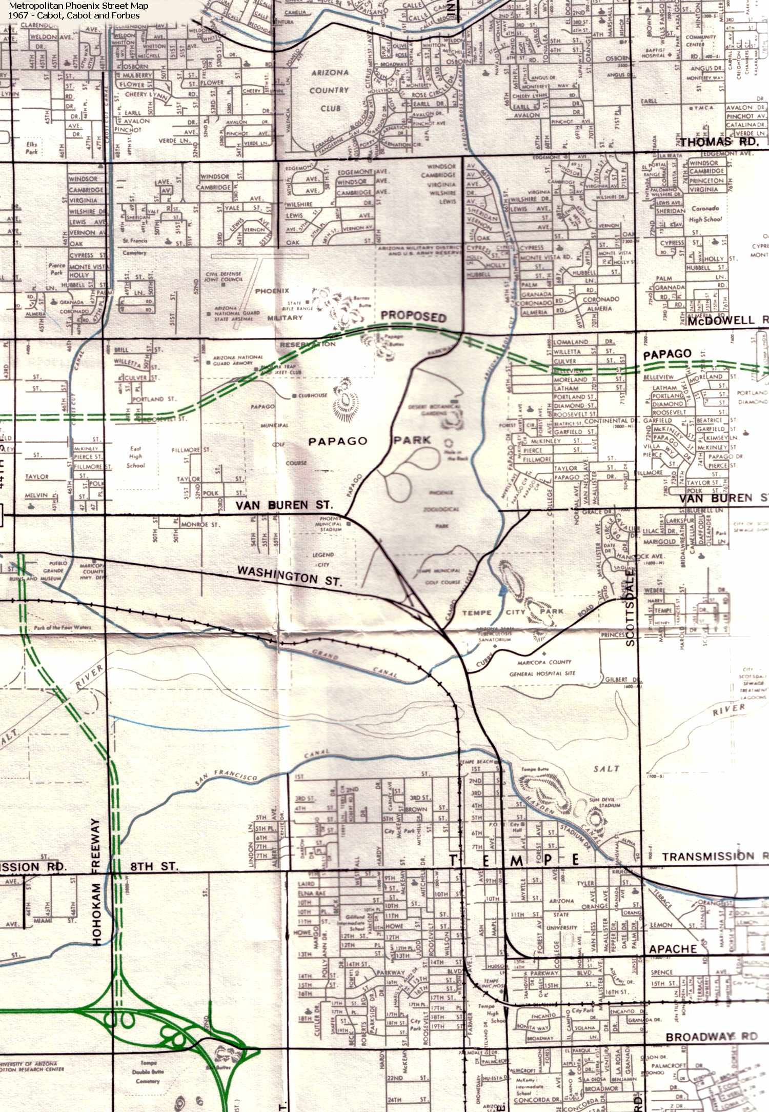 1967 Street map. More houses. Now we have the Sherwood heights and Hyview neighborhoods. It appears at one time the Maricopa County General Hospital was to have been built on the Tempe part of the park south of Curry Road. The big thing is the planned freeway. The map shows a proposed route (the big green line) of the Papago Freeway through the park. Yuck!
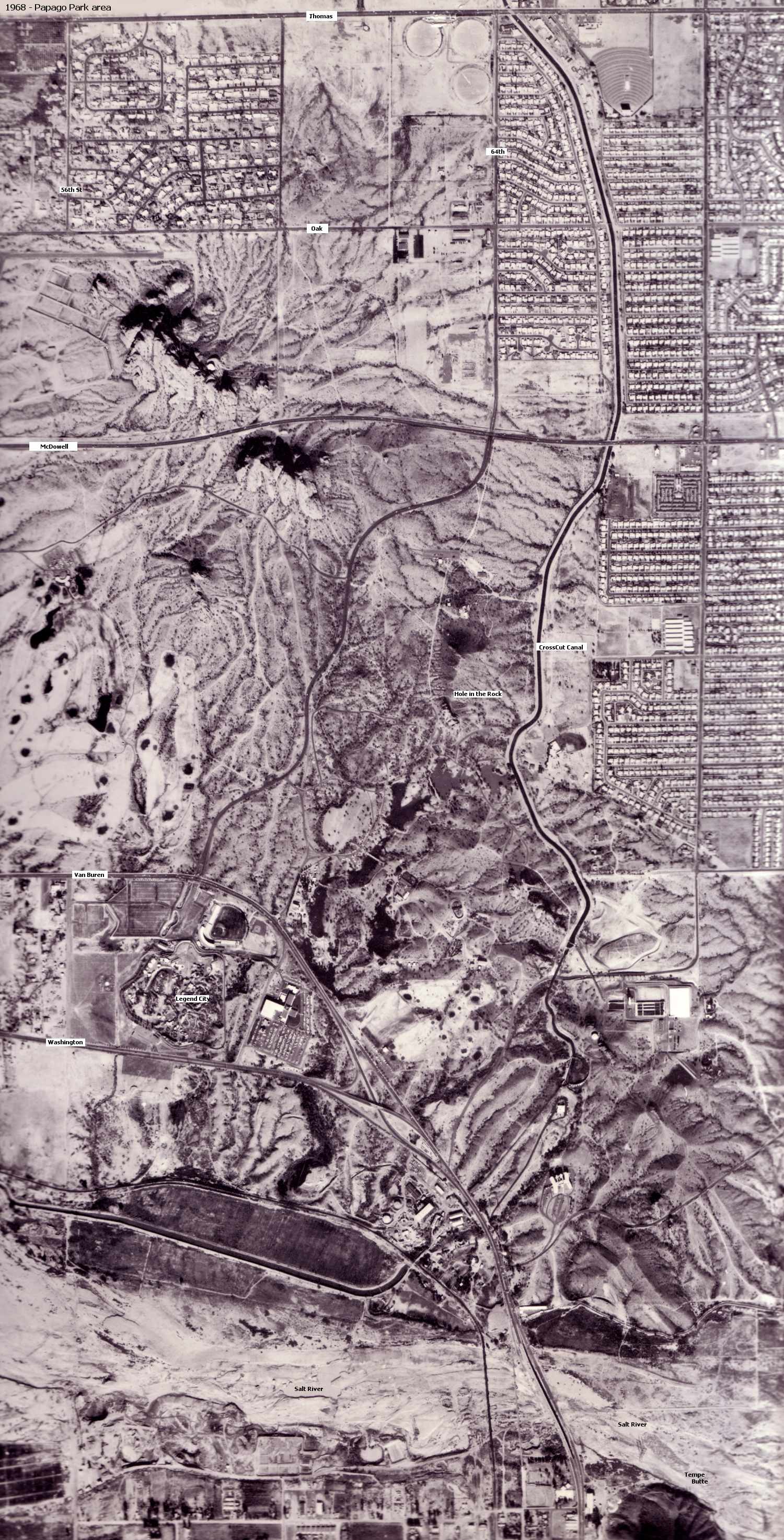 1968 Papago Park aerial view. This is an important photo showing the last of the old, traditional park before the changes in the 1970s that are still with us today. Notice the remains of the old POW Prisoner of War camp north of McDowell. The hospital complex and part of compound 5 are still visible, as well a few administrative buildings on Oak Street. Notice the long gone Roundup drive-in movie theatre at the top next to the Crosscut Canal. Most of all, notice Legend City on Washington Street, Arizona's own 2 dollar version of Disneyland.

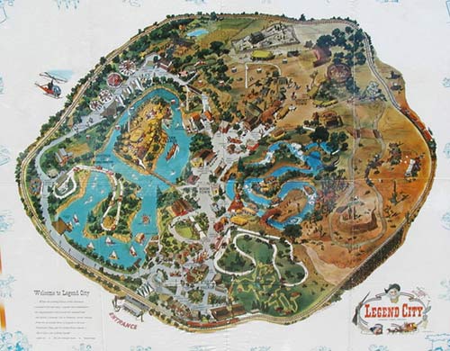 Legend City. Note: At one time, Legend City claimed to be the 4th largest Amusement Park in the country! Legend City memorabilia are now great collector's items on Ebay. I tried to buy the map pictured here but gave up at about $100. Update: I have a question... Does anybody remember another defunct Amusement Park called "Frontier Land" that was supposed to have existed in Tempe? This info was listed in a web site about defunct amusement parks.
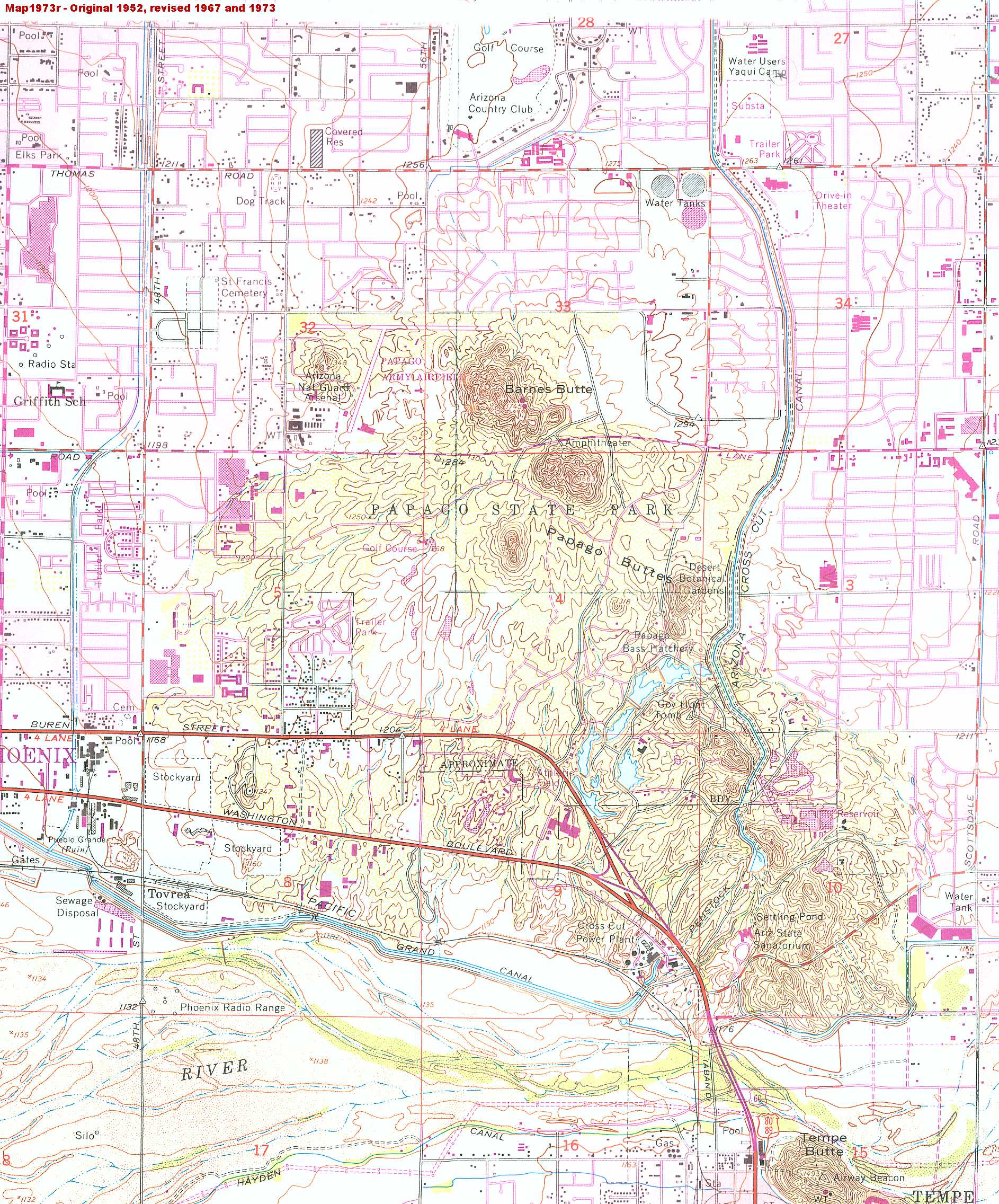 1973 BLM map. Based upon a 1952 version and updated in 1967 and 1973. It shows the general layout of "Arizona State Park", including the bass fish hatchery, Gov. Hunt's pyramid tomb and the State TB Sanatorium. I am surprise to see the old fish ponds at the corner of 62nd street and Thomas Road - I though the Las Casas townhouses had already been built by this time. Also notice the world famous Tovrea Stockyards on Washington. Famous for their size (1 mile long) and smell (good for 10 miles in the summer). I remember going there to shoot doves as a kid - me and a thousand other people. It actually rained lead. One last thing, the old road under the Aqueducts (called 'Campo Alegre'?) across Zoo and down near the Penstock ditch was still open. It was a great shortcut between Scottsdale Road and Van Buren / Washington Streets, but this road has been closed for decades!
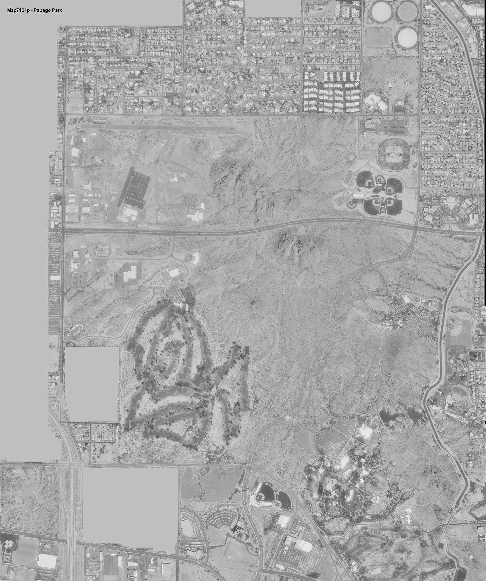
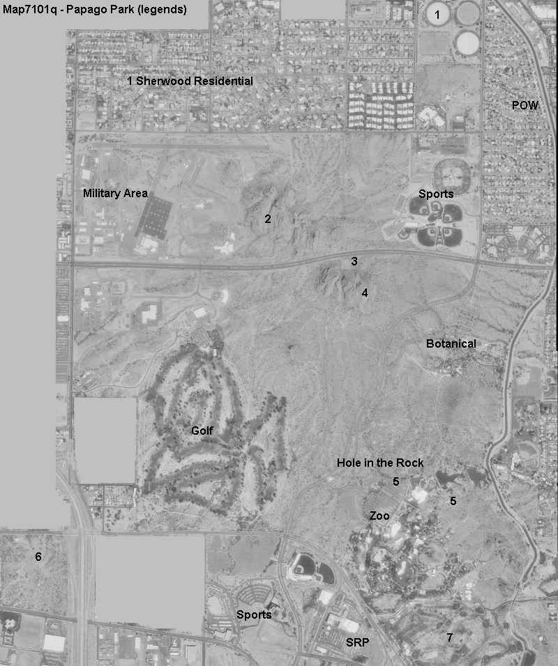 Papago Park. This was the first image I found of the Papago Park region. I believe it was taken in about 1988, give or take a year. The image on the left is the larger, with no labels. I added some location names to the smaller map on the right, to identify main features in the photo. Actually, this is 1990s technology from the Microsoft Terraserver website. The reason for this image was to see if my house is was visible. It is.
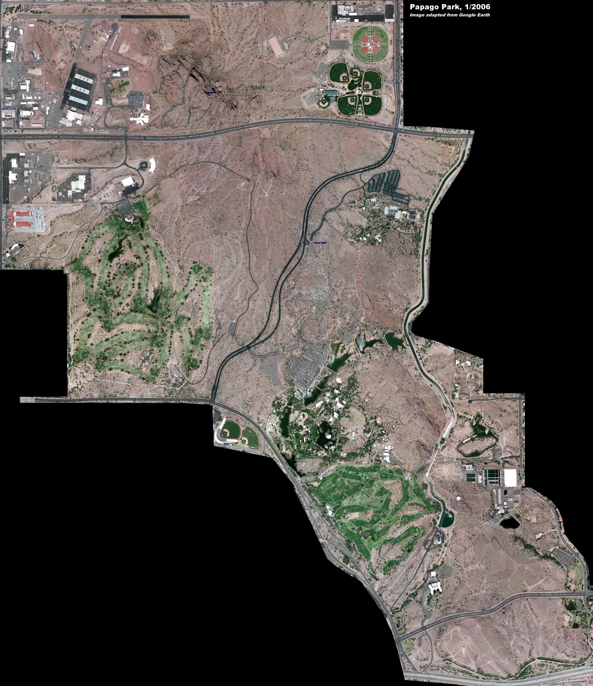 Papago Park 2005 Aerial View. And this is 2005 technology from Google Earth. Actually the resolution could be much better (higher), except that the file size would have been unbearable. The reason for this image is to serve as a standard to compare any changes that may happen in the future - or will happen.
The fact is that Papago Park is once again undergoing a "development plan" that will bring changes. This is supposed to happen in time for the Arizona State Centennial Celebration in 2012. I wanted a fairly good picture of the park as it is now (12/2005) so I can use it to compare against any changes on the future. Maybe they will pave the whole thing over and make it a big parking lot for ASU (Arizona State University) students (just a little to the south of the park) which is now the largest single campus university in the US with 55,000 students. I have no idea at this time as to what changes will be made. The word is that the Cities of Phoenix, Tempe and Scottsdale are working on a joint plan with some 'think tank' in London and Washington DC, but they are keeping us peons in the cold. I have no idea at this time as to what changes will be made.


 I would like this page to look like and be as complete as this other page I have. It is about maps of the City of Rio de Janeiro, Brazil. I don't know which is harder - collecting or finding maps of Rio de Janeiro for the last 400 years, even living 6,000 miles away, or finding detailed maps and pictures of Papago Park in the last 100 years, living right next to it!