Papago Park Centennial Project for 2012
My Plan for Papago Park
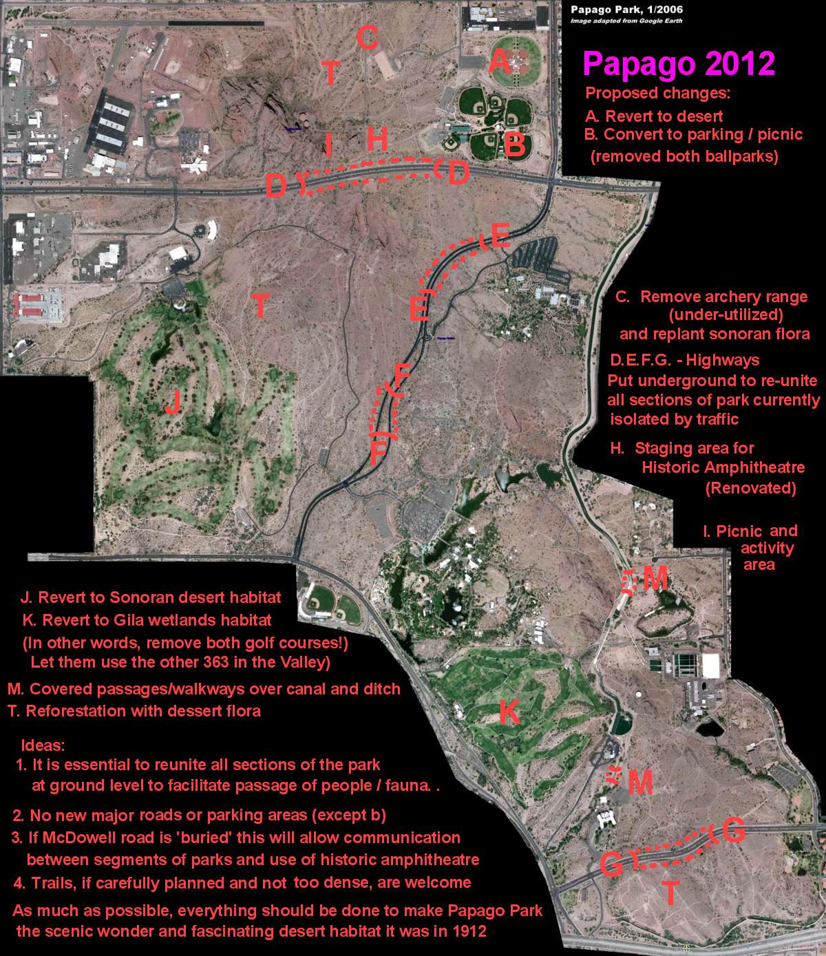
 Here is my project for Papago Park 'Improvements' (Click on image).
Not that anyone cares, but here is what I would do with the park if I had authority and money:
A. First of all the baseball/softball fields built in the 1980s (?) should be taken out. They sit on top of the ashes of the old POW camp. This area should revert to Sonoran desert or be used as a picnic area in a desert setting, with mesquite and palo verdes planted among the carnegiea gigantea (Cereus giganteus)- the magnficent giant saguaro cactus.
 Keep out! Area reserved for rich jocks.
B. One set of baseball fields was not enough, so they built another one. These four fields are not even used by the public, but are reserved for (rare) winter use by the "Cactus League" pro team. The "No Trespassing" signs really bother me! The area could be better utilized as a parking and service area (including toilets) for the northern part of the park. I doubt seriously that Woodrow Wilson had this in mind when he designated the area as "Papago Saguaro National Monument" in 1914.
Neither of the ball fields should have been built in the first place. The fact is that not only are they a source of intense light polution (the floodlights) but they are incompatible with the original stated purpose of the park when chartered almost 100 years ago, which stated the "natural objects" were was to be preserved for future generations. There are plenty of other athletic facilities in other parks and schools that could be used.
C. The archery range is under-utilized. I really don't have a problem with it, but it would be nicer if the area was replanted. The fact is that the land north of McDowell was scrapped in the 1930s for WPA, CCC and SPSA camps and later for the POW facility. It has never recovered from this. At least the huge Velodrome project of the early 1990s - that was to have been built on the site of the archery range - was rejected because of local neighborhood opposition.
D,E,F,G. This is an absolute necessity. To unite the park and restore a sense of continuity, sections of the main roads should be put underground. More about this below.


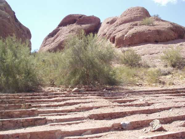
 Views of the historic amphitheater.
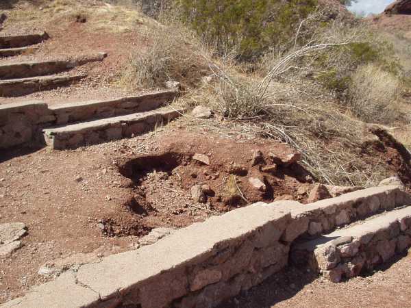
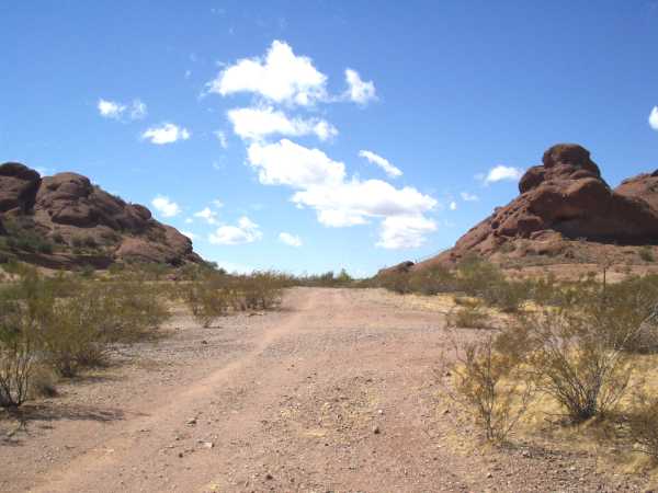
H. The historic amphitheater could be used once again if McDowell Road were buried for about 200 yards where it runs between Barnes Buttes on the north and the Papago Buttes on the south. A large flat area in front of and slightly below could also the used for gatherings. In other words, you could either put the audience in the amphitheater or in the common area in front of it. Parking would be at the ex-ballparks (B), at the clubhouse for the ex-Phoenix golf course or at the botanical gardens. Notice the deterioration and neglect of the site. Notice how McDowell road cuts right across the front and makes the theatre unusable - unless you want to sit there and watch cars go by. The last picture on the right shows the old dirt road that was used up to the 1940s. Sunrise Point is on the right and the amphitheatre is on the left. The picture was taken at the end of the road beyond the "No Trespassing" sign.
I. I have mixed feelings about the location designated as "I" on my project. This is the area directly below and east of Barnes Butte and south of the 2 water tanks, around what was known as "Sunrise Point" in some old maps. This used to be a public area, in fact the remains of picnic tables are still visible. It is now behind a fence in National Guard country. It would be a great place to climb and explore, and watch one of the beautiful Arizona sunsets. Since the land is not used - I have never seen anybody in it - it would be nice to have access. On the other hand, as far as I can tell, it is where most of the large critters in the area have their dens. So, leave this quiet protected area as it is.
J. The two golf courses should never have been built. Maybe they made sense in the 1950s, but today there are 363 other places to hit little round balls into little round holes in the ground, if that is your thing. The Phoenix Papago Golf course should be converted into desert habitat, trails and even picnic areas. The club house and parking areas could remain.
K. The same for the Tempe Golf Course. This area, however, should be converted to a Gila riparian wetland habitat, similar to that which existed nearby before the damning of the Salt River when the National Monument was created.
M. I would also like to see covered, ground level walkways over the canal and the release ditch. Actually this waterway is pretty much out of site and unvisited, but it is one of the nicest and most interesting parts of the park.
T. Large areas of the park need to be replanted, and to its credit, the City of Phoenix is doing this (Well, maybe except for planting a very dead saguaro cactus in front of Hole-in-the-Rock as seen here in March 2006:  ).
).
Of all the changes to the park, what I would like to see most is a continuous ground-level connection between all parts of the park. This could be achieved by burying 3 or 4 sections of the roads crossing the park for a distance of 100 to 200 yards. Easy for me to say! As it is now, McDowell, Galvin Parkway and Curry Road all cut through the park and totally isolate the three areas. Doing this would allow free passage of people and wildlife between the different areas of the park. I do not think that overpass walkways would achieve this - the road would have to be put underground. Fortunately, the geography and use of natural hills and slopes in the terrain would make this easy. Also, this would enable the use of the historic amphitheater, which has been mostly unused since McDowell was paved and widened in the 50s. As a boy I remember going to sunrise services and concerts there - a truely gorgious experience - but as far as I know it has not been used for decades. If the portion of McDowell Road in front of the amphitheater were put underground, it would be usable, again. It could, in fact, rival any outdoor concert or meeting area in the US. For parking there would be the new areas at the corner of 64th (B), and the parking lot of what was the Phoenix Golf course, and the existing lots on Gavin Parkway. Please note: There is an underpass on Curry Road, used mostly by the stables. Another larger underpass should be put on Curry near the old TB Hospital building (Now ASU Community Services) This would take care of the Southern part of the park (in Tempe).

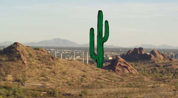
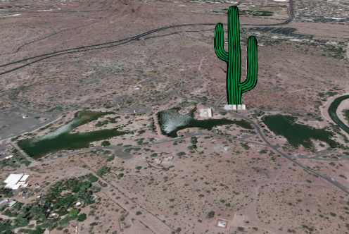
 The jolly green giant...
There is no way that any normal, kind, caring and public-minded person (like me) can accept the idea that parts of Papago Park should be used for (quote) offices for golf associations (unquote). The idea is ludicrous beyond anything imaginable. I would rather see the 600 foot neon green saguaro cactus tower be built than see even a janitorial closet designated for golf offices. In fact, I have two rare views of the saguaro project, known as the "jolly green giant", as imagined by an unknown artist. The tower project was to be located directly behind the Hole-in-the-Rock, as pictured. I mean, you might find the proposed idea odd at first glance, but it grows on you. They didn't like the Eiffel Tower either at first. It could be seen 20 miles away, and it would be a great conversation topic, so much that we wouldn't hear about Sheriff Joe or that I-forget-its-name NFL team anymore. The planes going to and from Sky Harbor would just have to fly around it. Sorry!
Well, that is it. Everything below this point will be a chronological account of events relating to the development of the park, as I become aware of what is happening. I admit that I am biased and opinionated. I may get some facts wrong, but I am willing to correct any mistakes. On the neigborhood emails quoted here, most names have been removed to protect the innocent! Anyway, The fact that good, reliable information on the Project is hard to obtain. This makes me skeptical and suspicious. Maybe I overdo it; Maybe not.
All 'Papago Park' Pages
Here are all the pages on this site that relate to the history, development, attractions and even the future of this area:


 Here is my project for Papago Park 'Improvements' (Click on image).
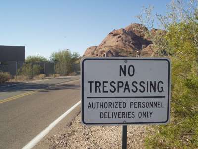 Keep out! Area reserved for rich jocks.
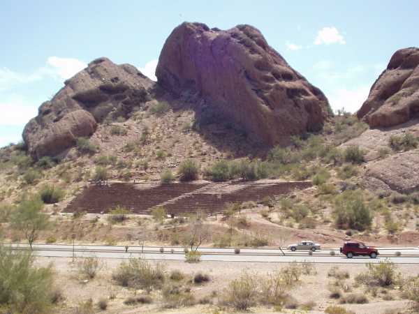
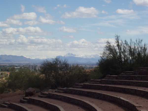
 Views of the historic amphitheater.
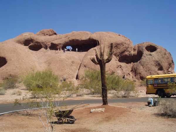 ).
).
 The jolly green giant...