MAIN MAP PAGE
I have collected quite a few maps of the Old Maricopa region. It is really interesting to see how long it took for exploreres really to understand the geograpgy of the region. Probably the biggest issue was understanding the location and flow of the rivers and how the Big Bend of the Gila worked. The fact that the main rivers initially encountered (Santa Cruz and Gila) by the Spanish and Jesuits all flowed north created some problems. Some effects of this confusion were that the rivers were named and renamed several times, or misplaced on the maps, and the strange fact that the name of a much smaller river (the Gila)is given to designate the combined flow of much bigger rivers (Salt and Verde). Anyway, the fact was that the Spanish had about 100 years of contact with the Santa Cruz and Gila before really exploring the Salt River. And of course, when exploring the upper Gila, they, like most travellers, would cut across the SOuther Estrellas (the infamous "Jornada de las Estrellas") and would re-encounter a river. When asking the Pimas "Is this the same waters?", they would truthfully confirm it was so. So that is how a Small River took over a big river. Anyway, I am gpoing to write a page on the rivers someday.
Anyway, back to the maps. Rather than list and show all the maps I have I will only put a few of the most important and interesting ones on this page. Too see all of the maps I have in electronic format, click here to see the "AllMap" page.
It is something of a paradox that Arizona was among the first parts of the US to be explored and the last to be mapped. Although most maps of Western part of North America lack detail, there are two that are of interest. These have some rough information on what is now upper Sonora and lower Arizona.
Below are about a dozen of the most significant or interesting maps, with a few explanations, covering a period of about 3200 years, starting even before the Plymyth Rock and Virginia Colonies, and ending at the end of the 19th Century (1895).
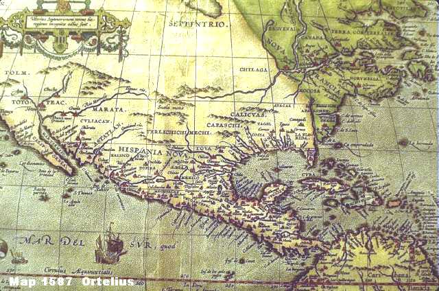
Map 1587o

Map 1696T
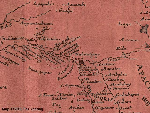
Map 1720G
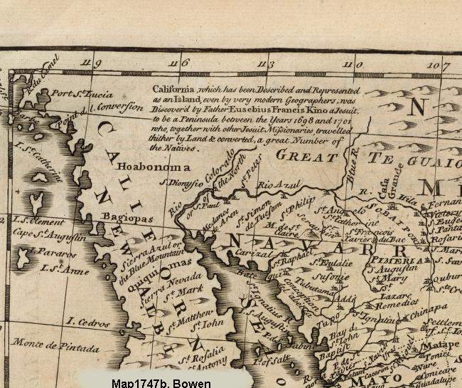
Map 1747B
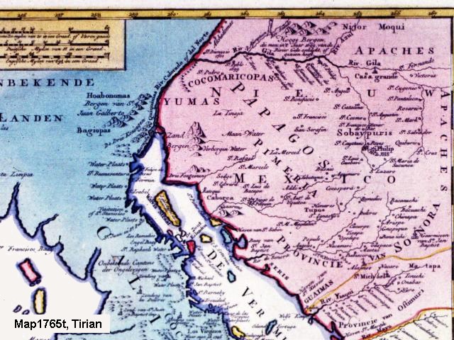
Map 1765T
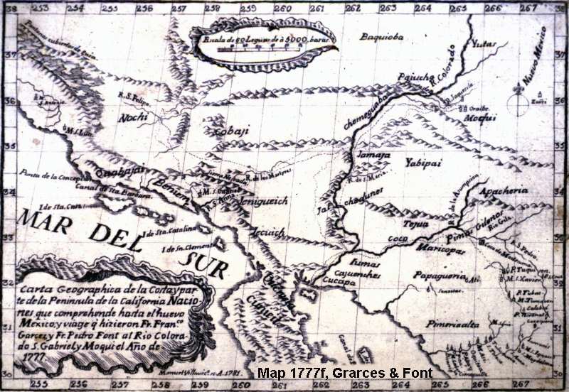
Map 1777F
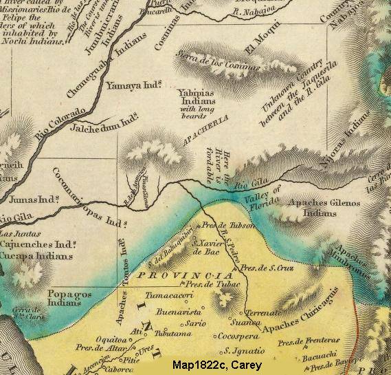
Map 1822C
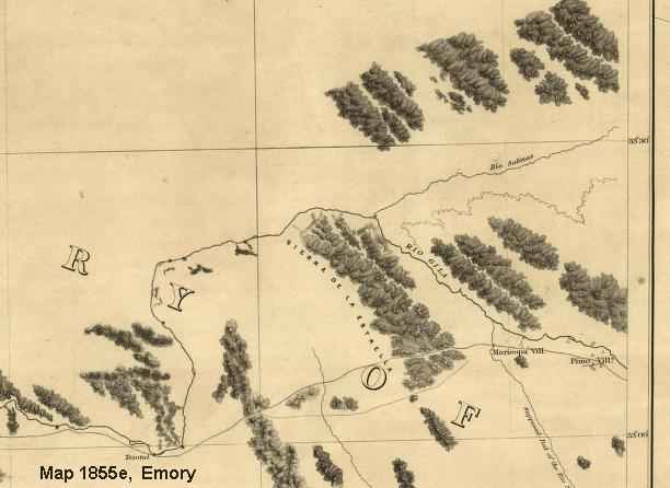
Map 1855E
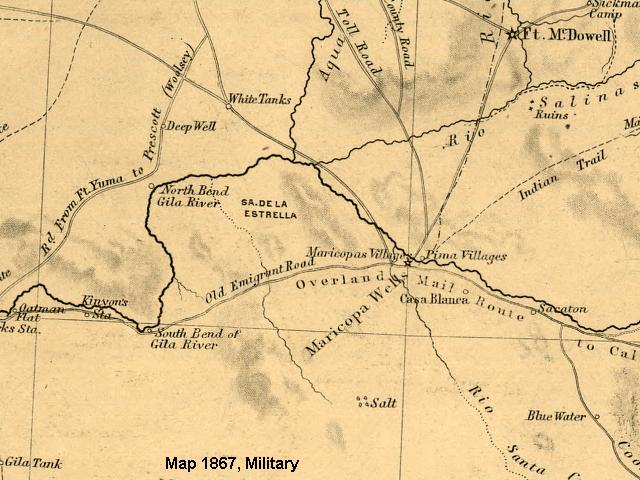
Map 1867M
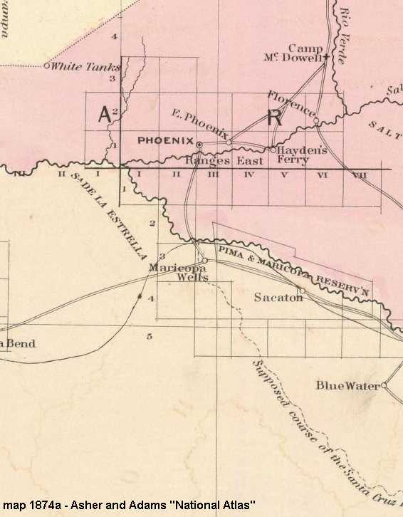
Map 1874A
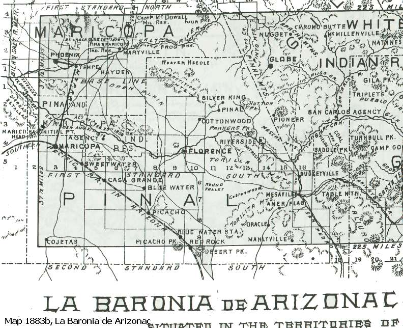
Map 1883B
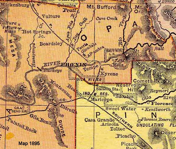
Map 1895C
 Click to see a listing of all maps.
A collection of all charts and maps in the collection, with thumbnails.


