
|
|
What we called the Patio Area is the very southeastern tip of the Sierra Estrellas. Historically it was the most visited place in the mountain range (at least until the 70's, when development began in earnest at the Northern part of the mountains!) For hundreds of years travellers going west would journey up the Gila River until reaching Pima Butte, near the junction with the Santa Cruz river. They would stop at the Maricopa and Pima villages for rest and water before starting what was considered hardest part of the trip - the 40 mile desert, from the Indian villages, across the southern end of the Estrellas, through the pass in the Maricopa range and then back to the river at Gila Bend. Starting in the late 1840's white settlers going west would use the same trail, stopping at Maricopa Wells and then following the old path west, cutting south of the Estrellas. his route would save them 2-3 days of travel (with wagons!), compared to the easier route following the Gila River north around the mountains.
For all travellers - Native American or Anglo - a mandatory stop was the small flat area at the end of the montain, directly under what is called Montezuma's Head. It was here that people checked their supplies and rested before heading west. Often the trip was made at night to escape the heat, hence the name "jornada de las estrellas" (journey of the stars).
p7
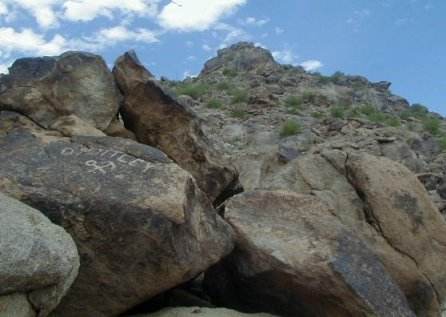
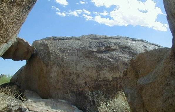
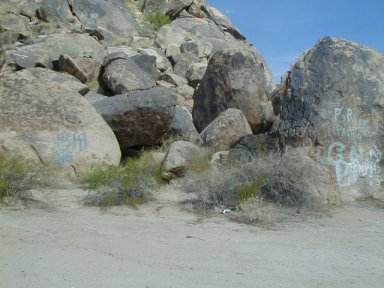
At Patio Area, looking up at Monetezuma Head point. Notice the pile of large rocks. For about 100 yards, the edges of mountain are covered with petrogliphs, natural shelters, and graffitti. This is the most histporic sot in the Estrella range.
The patio are is a jumble of large and small rocks piled on top of each other. There are dozens of covered areas under and between rocks where people have sought shelter from the elements. Here they carved hundreds of figures figures in the rock, called petroglyphs, and ground native corn, creating bedrock morters still found in abundence.
The bad news is that people are rapidly destroying the figures or carrying anything than fits in a pickup!!. In the 50's and 60s the site was very clean, now broken glass and trash is everywhere. Some idiots have even used spray paint on the rocks, causing terrible damage to the petroglyphs. This is Reservation land, and if the Indians were to shoot anybody with a paint can, it would be fine by me. As John Annerino said in a book, ours might be the last generation to see these figures (or whats left of them!) More info on this area is in the pages on Maricopa Wells.
Anyway, here are pictures I took in August 2000 on a trip to Patio area and up the Mountain
p2
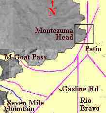
General map of Patio area location.
p1
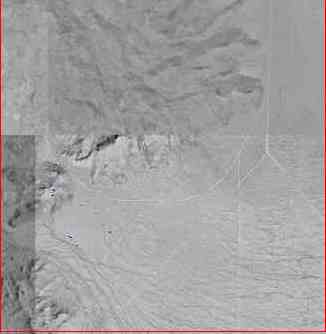
Satellite photo of area. Too bad overlays are not all same resolution and clarity.
p3
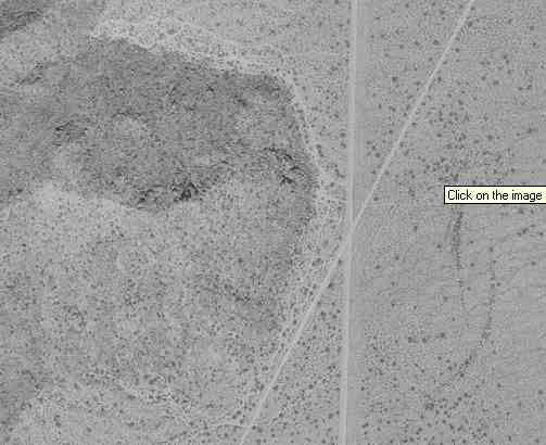
Blowup of Patio area from satellite picture above. Small dot objects (trees) are about 6-8 feet big. Patio is in middle of pic, just left of "X" where two roads cross. The many walk paths along the rocks are visible.
p4
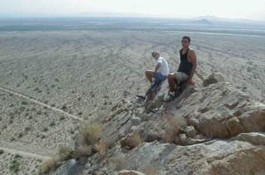
Dan and Chris from near Montezuma head. The view is directly east to Pima Butte (small hill in middle area). Maricopa Wells site is just above Dan (black shirt), beyond river bottom.
p5
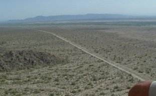
Looking north towards South Mountains. Not much down there.
p6
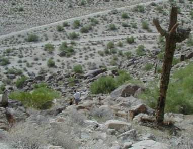
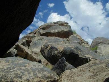
From top, looking down towards Patio. Notice the hawk nest in the dead cactus. The Pimas and Maricopas kept a watch on all travel from a lookout on Montezuma Head.
p8
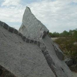
Bboulder blasted into pieces. Why would some idiots blow up a rock? to carry off Indian art?
p10
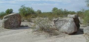
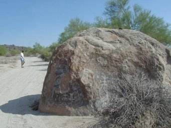
One of two most famos rocks. This is the Peralta marker rock. This picture was taken in year 2000. In other place here somewhere are pictures taken in 1992 and 1880s. Notice square human figure on right.
p11
Close-up of Peralta Marker. Its almost gone.
p11
Just what we need: spay painted Kokopelli and flowers on the old rocks. Grrrrrrrr!
p12
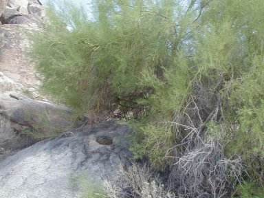
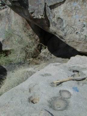
A bedrock morter under Palo Verde tree. Used to grind corn. After rains these are filled with water and much appreciated by desert fauna.
p13
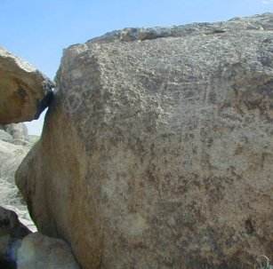
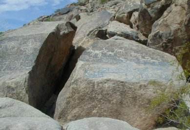
Jumble of rocks. Many of these have can be used for shelter underneath. The petroglyphs are faintly visible under the graffitti.
p14
Five goat rock. The best figures on the whole mountain. I remember these from the 50s. Somewhere on this site there is a picture taken in 1992.
p15
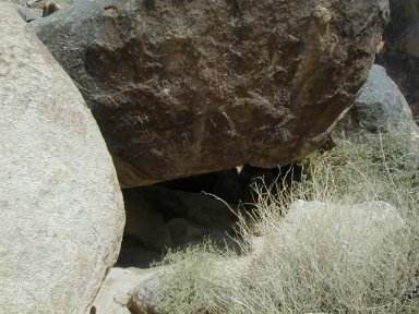
Under rock shelter
p16
More rocks. My guess is that the rocks piled together at bottom of hill all came down from the top.
p17
Several bedrock morters
p18
Chris on one of the roads crossing the area. More figures in rock.
p19
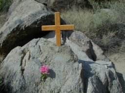
This was new. Wasn't there two years ago. Go figure!
![]()
![]()
![]()
![]()
![]()
![]()
![]()
![]()
![]()
![]()
![]()
![]()
![]()
![]()
![]()
![]()
![]()
![]()
![]()
![]()
![]()
![]()
![]()
![]()
![]()
![]()
![]()
![]()
![]()
![]()
![]()